
IF YOU see a man or woman in your road with a high-vis jacket, a hard hat and a funny looking pole they are probably doing work of national importance.
Surveyors from the Hampshire-based Ordnance Survey (OS) are out every day in all weathers updating the maps of Britain.
Every day hundreds of thousands of amendments are made to the master map with the changes being added to the database within 24 hours of the survey being made and information relayed to the Land Registry soon after.
No mini-roundabout, layby or bus stop goes unmeasured. On every new housing estate the OS surveyors measure each home and plot.
And I’m proud to say I’ve done my bit for keeping the nation’s charts in order.
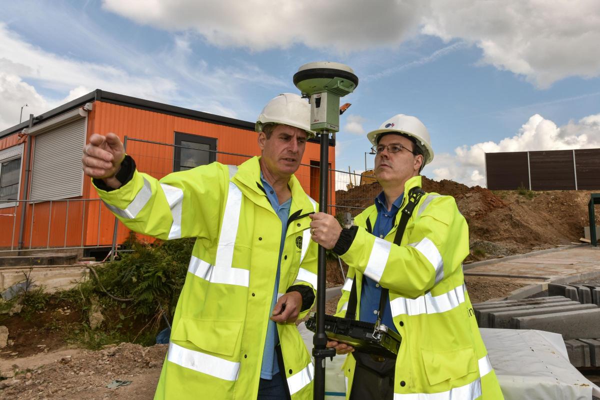
Of course I started big – no cycle path or traffic calming pinch point for me. I tackled the largest new building in the area – the giant Lidl depot at Nursling - which we visited prior to its opening.
My teacher was the patient Tony Vanderhoek, from Totton, who has been a surveyor for 30 years, 27 of those with the OS, and covers the Southampton area.
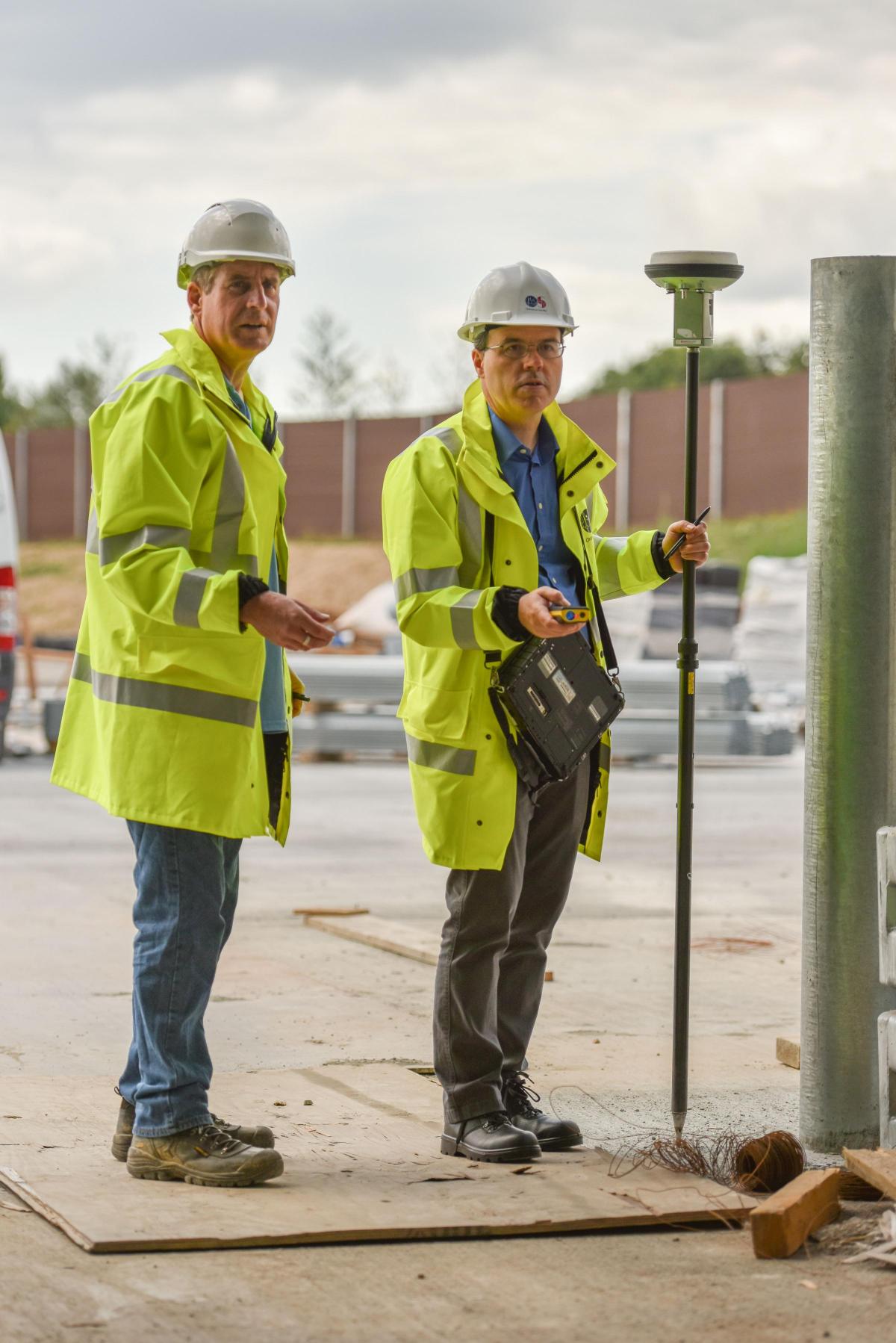
He instructed me in the ways of his magic Gandalf staff which is a highly-sensitive Leica GPS unit, used to pinpoint our position to within a centimetre.
To do this the GPS needs to “see” the satellites above. In our case the connection was made and the requisite coloured lights on the unit atop the 1.8m pole flashed to give us the go-ahead.
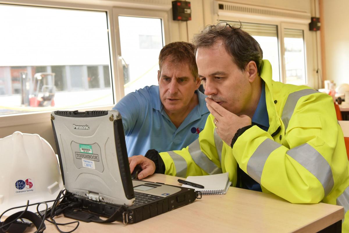
Then we made our way round the massive depot building. First we lined up with one corner and recorded that point. The Leica “talks” to the surveyor’s tablet computer, Panasonic Toughbook, worn on a strap round the neck.
The surveyor, in this case me, marks each point on the screen.
It took me little while to get my surveying eye in but once I had the knack of it we made rapid progress making a digital dot-to-dot diagram on the computer screen – with a point appearing for each corner or protrusion.
Tony explained that although this was a huge building it was in fact a relatively easy job because it is a fairly regular shape with long straight walls which have few features to interrupt the line apart from a roofed canopy on one side and a loading bay at one end.
We recorded the dimensions of the bay with Tony’s other gadget, a hand-held laser rangefinder, not much different from those used by estate agents to measure up your living room.
It took us about 45 minutes to mark out the main building which measures 312m by 125m.
We then sat down and using a stylus joined up the dots on the Toughbook screen to create the outline of the depot overlayed on the existing map.
Perhaps wisely Tony had taken the precaution of making a prior visit the Lidl depot to do his own measurements.
However, to my surprise it turned out that my amateur efforts were just 4cm out at one end and 10cm at the other - within the tolerance allowed by the OS.
It’s a brilliant system and I’m sure most jobs are far more complex than the one entrusted to me.
Tony explained that when he started with the OS they were still using a tape measure (just one - measuring 30m), an optical prism and theodolite and marking up their work on a plastic map.
There were also no mobile phones and now way of telling if the surveyors had fallen off a cliff or disappeared down a mineshaft.
“You worked on your own. They told you where you were going that day and off you went.”
The new technology has cut the time of mapping new features to a fraction and consequently the number of surveyor employed by the OS across the UK has fallen from around 1,000 when Tony started to just over 250 today.
A few days after my outing with Tony, I returned to the OS offices to see my additions to the map put onto the master version with the aid of Simon Duquenoy, senior technical product manager, and Izabella Hurst.
They showed me the building, which has its own unique identification number, as pink block sitting in its bare yellow plot, Tony returned at later date to map the car park when it was completed.
A red line cutting through the building shows that it straddles the boundary between Southampton City and Test Valley Borough councils.
On another screen appeared a string of code, which is how the data I saw on the map was transmitted to the Land Registry.
My morning’s work had joined 460 million other features on the master map of Great Britain.


Comments: Our rules
We want our comments to be a lively and valuable part of our community - a place where readers can debate and engage with the most important local issues. The ability to comment on our stories is a privilege, not a right, however, and that privilege may be withdrawn if it is abused or misused.
Please report any comments that break our rules.
Read the rules hereComments are closed on this article