


KNOWING Southampton’s boundaries has always been of great importance – so much so that children were once ceremoniously harmed in the hope of having them remember.
Arriving at Southampton by car you pass signs saying “Welcome to Southampton” showing that you are entering the city’s confines. As you drive around the city, signs will welcome you to the different parishes or wards.
People such as surveyors are often seen in archives examining historic maps so they can confirm a place name, land boundary, location or some other important local geographical detail.
Accurately defined land boundaries are important for legal, financial, political and ecclesiastical reasons and fortunately we have detailed Ordnance Survey maps to help us.

That has not always been so, for early maps were neither accurate nor detailed despite having been in regular use since the 16th century.
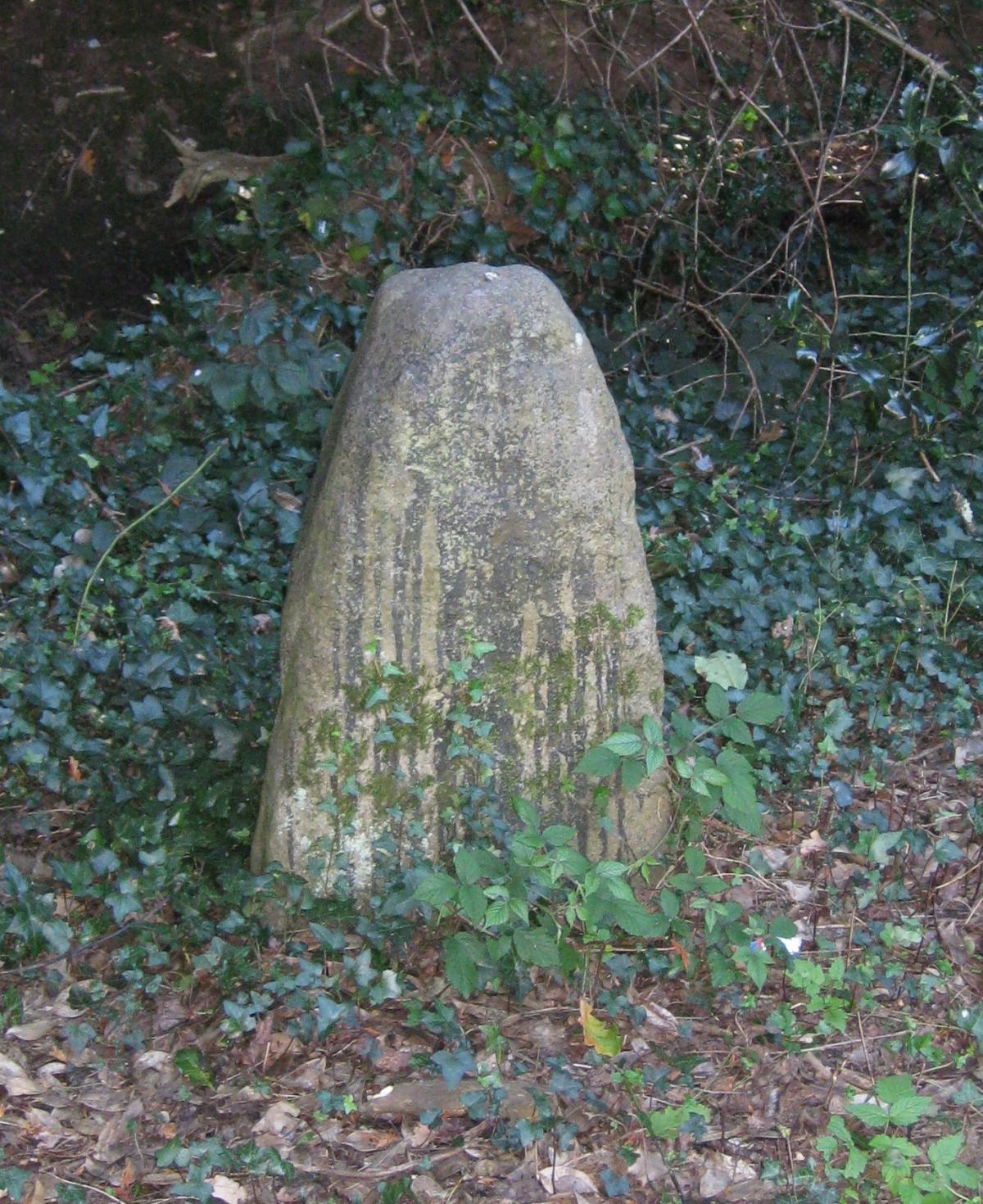
In the absence of maps and signposts, town and parish boundaries were marked by landscape features such as rivers, bridges or a tree - often known as a Gospel Tree - and by large stones.
A description of the boundary would be recorded in parish documents and annually parish officials and parishioners, including children, would walk the boundary ensuring that the markers were in place and that there had been no encroachment.
It was important that children learned the markers and the boundary for the future which they did by beating the markers with willow sticks. The officials would also knock the children’s heads against each stone, submerge their heads in a river or inflict pain to ensure they did not forget.

This annual ritual was known as “Beating the Bounds” and, though no longer necessary, it is a tradition that continues to this day in many places including Southampton. Much to the relief of youngsters countrywide, children are no longer harmed during the process.
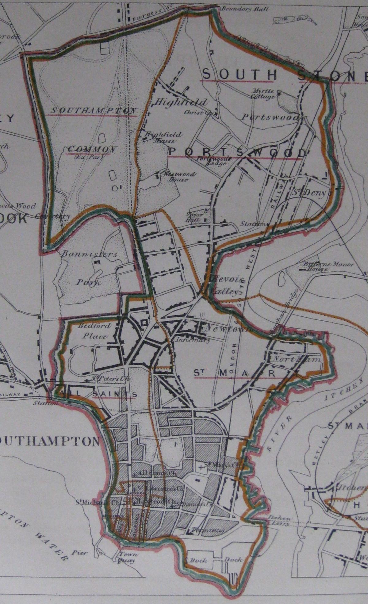
A Southampton Court Leet document of 1652 describes the town boundary at that time, as commencing from the Ackorne or Archard’s Bridge, roughly where Central Station is.
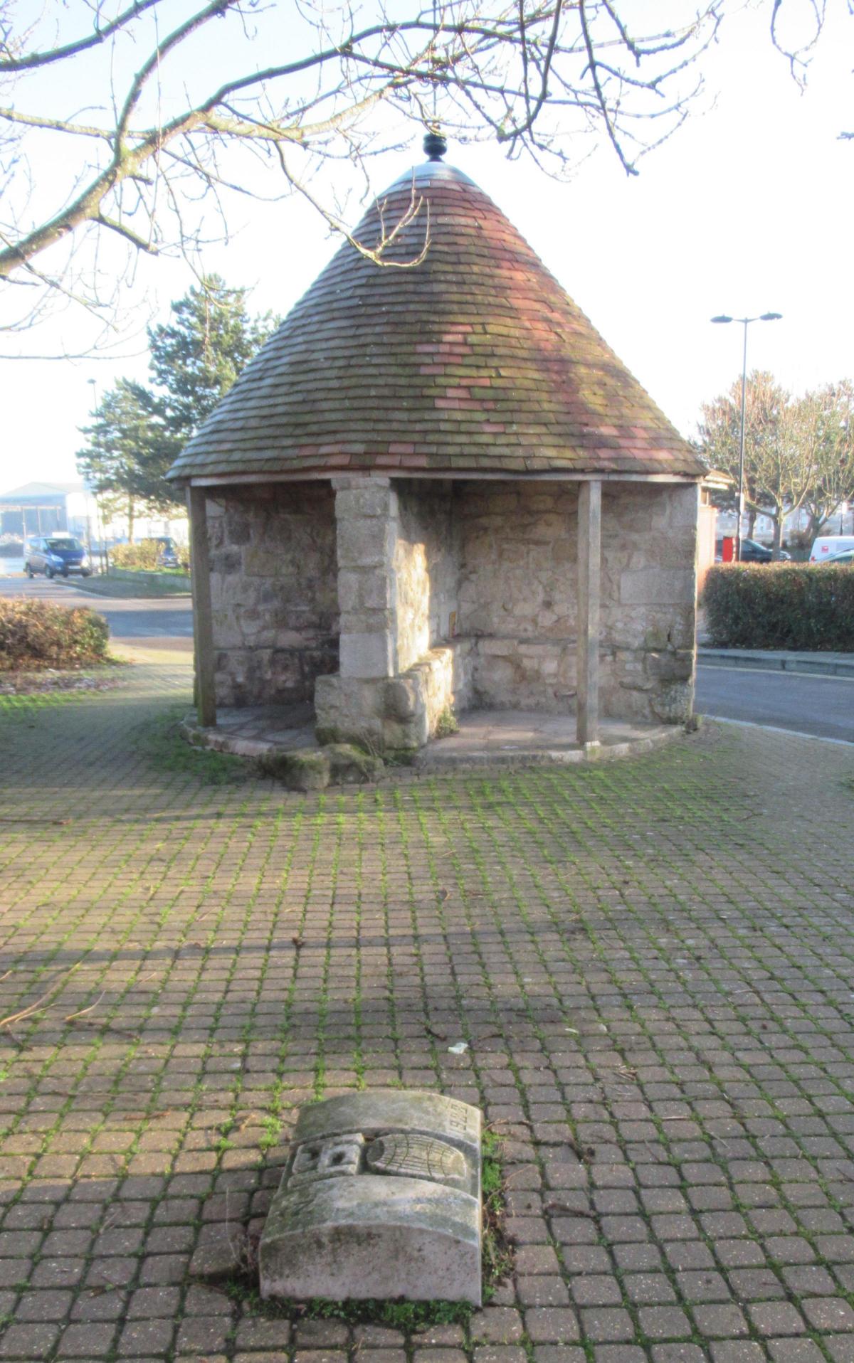
It then continued along the west side of the Common following the Rolles Brook and on to the Hode cross, marked by a stone which still stands in the top section of Hill Lane, albeit on the wrong side of the road.
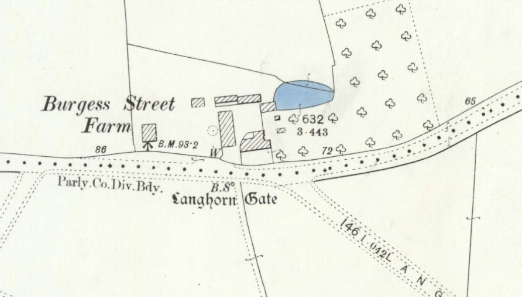
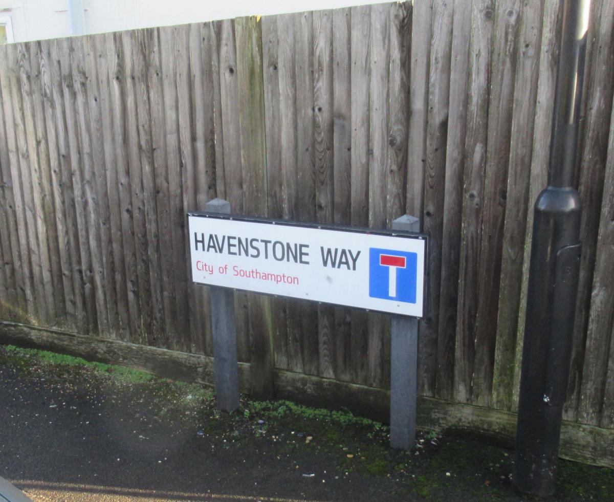
From there, the boundary continued eastwards along Burgess Road - or Street as it was then known - passing the Rosemary stone to the Cutted Thorn Cross, the former site of the Court Leet. From there it passed the Burle or Borrell stone cross, located opposite the Burgess Road library and through Langhorne Gates at Swaythling to the Havenstone in Hylton by the side of the Itchen, downstream from Woodmill. A boundary stone was positioned at Langhorne Gate in 1461 and was known to be there in 1961 but sadly is no longer.

From the Havenstone the boundary proceeded along the riverside to the Hegestone, which was near Southampton’s football stadium and on to a stone at Crosshouse by the Itchen Bridge.
It then continued through God’s House and the Water Gate encompassing the town by the Test back to the Ackorne Bridge.
The boundary was subjected to change from time to time by High Court rulings as happened in 1652 when Banister was allocated to Shirley.
During the 19th century the town’s political boundaries were surveyed and mapped twice as part of political reforms.
In 1895 the boundary was extended to include Freemantle, Shirley, and part of Millbrook and in July 1920 Woolston, Sholing, Bitterne Manor, Bitterne, Bitterne Park, Swaythling and Bassett were added.
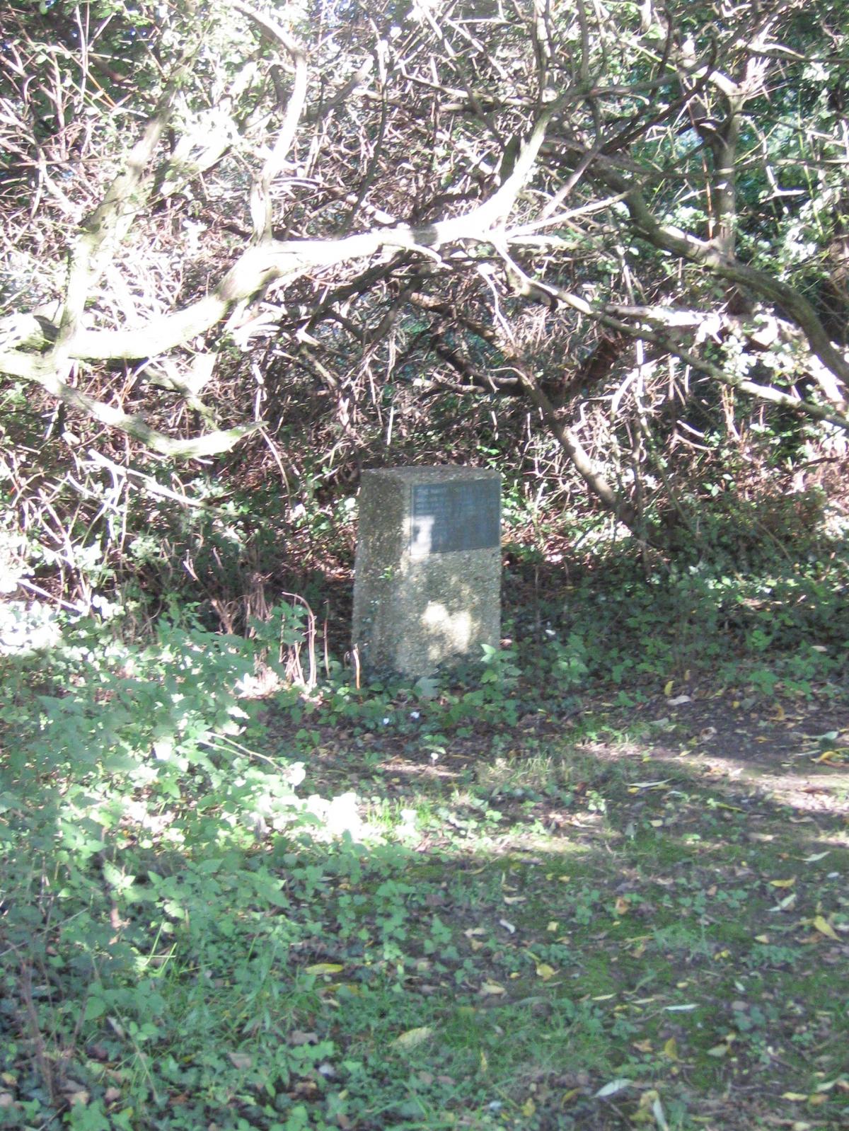
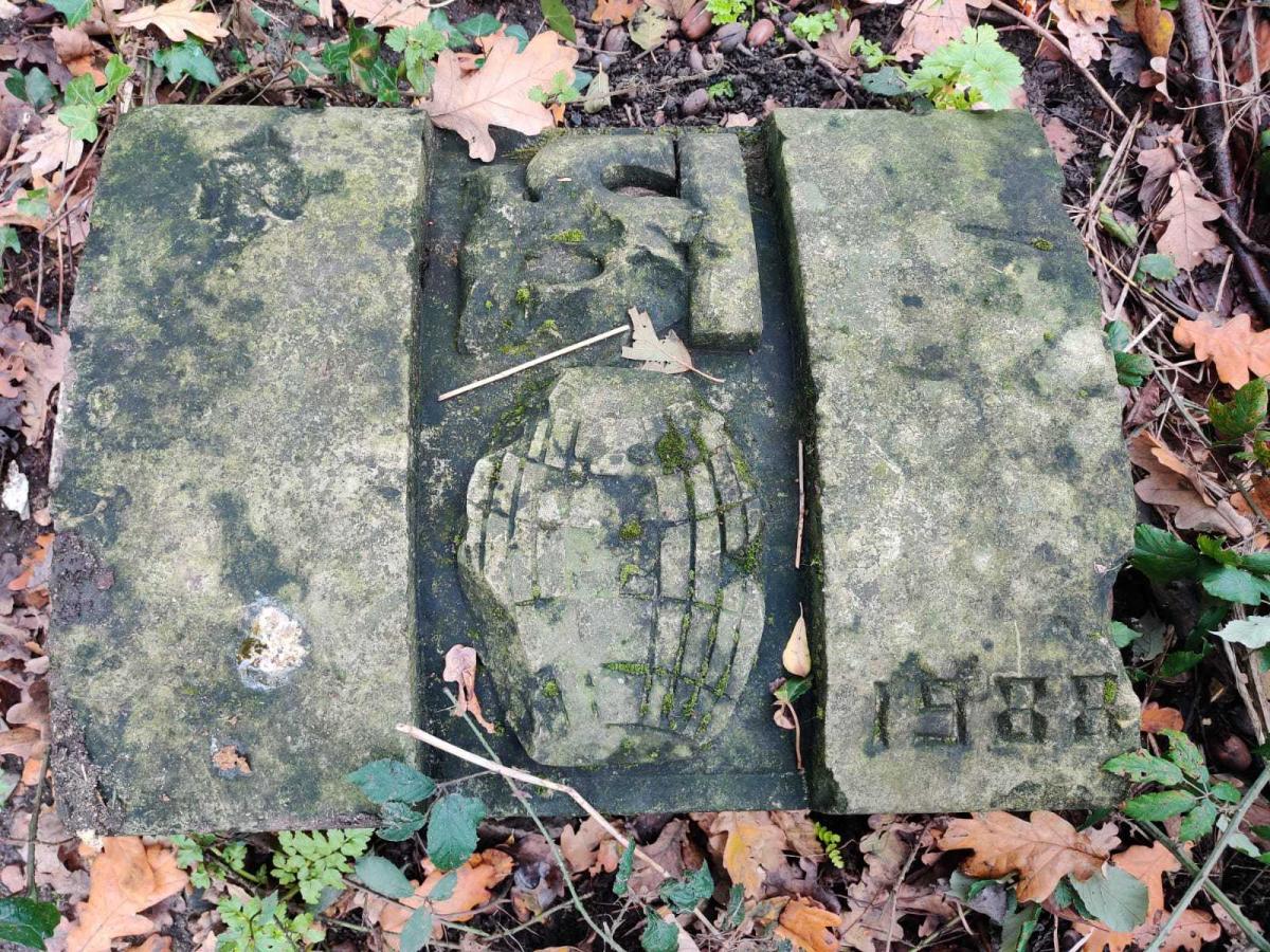
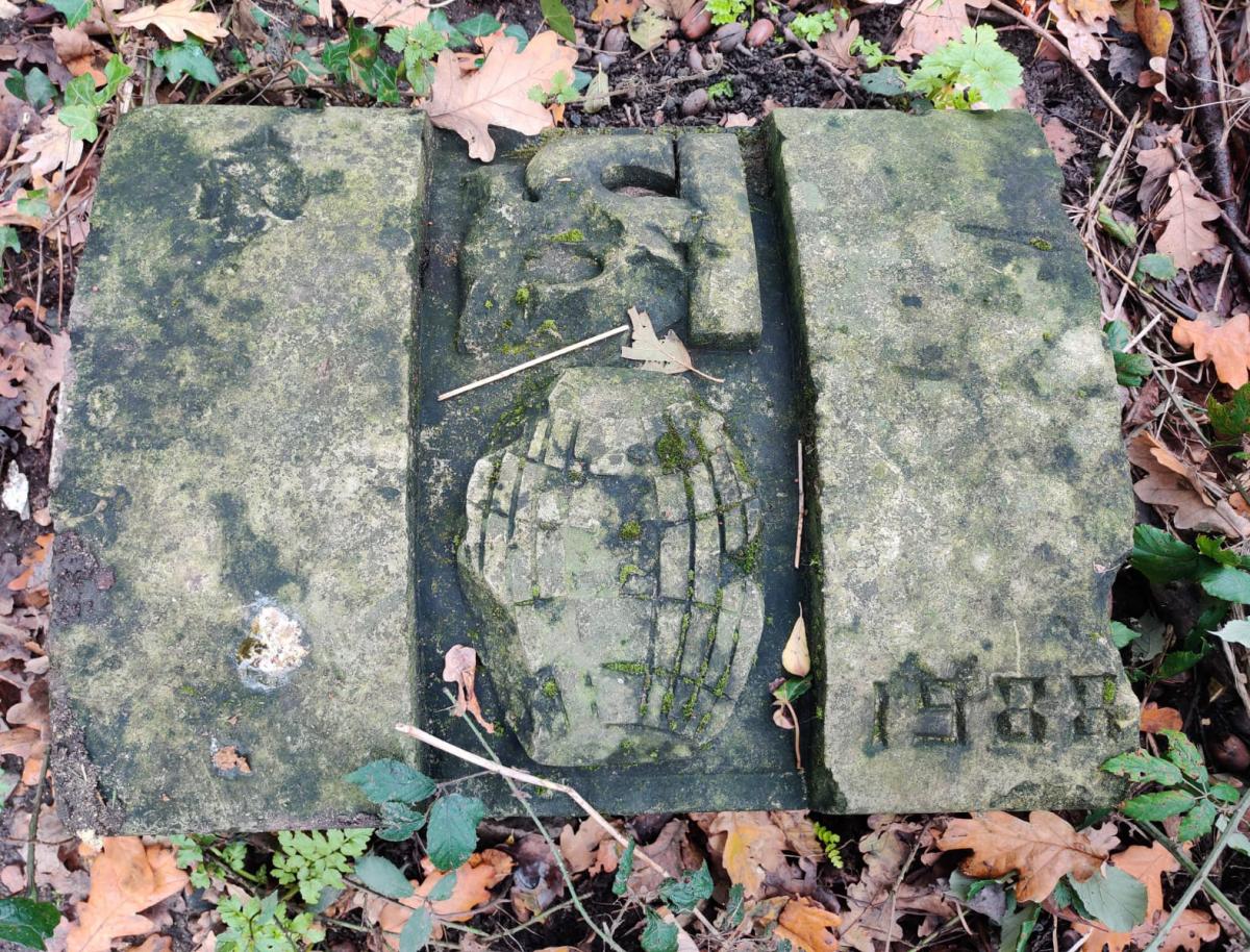
Following a Council “Beating the Bounds” report prepared in September 1985 a set of Rebus Stones were created to mark the City’s new boundary. The stones were designed by the City Architect’s department and show a visual pun on S(outh) H(am) Tun (picture of a barrel), with an arrow pointing North and the year 1988. The stones were recycled from the former Civic Centre Rose Garden.

The first three stones were installed in 1987/8 by Redbridge Bridge, at Cutthorn and the Crosshouse.
A further nine stones have been installed and it is a challenge to locate them.
Further sites included: Fernyhurst Lake; Lord’s Wood; Sports Centre; Bassett; Itchen Valley; Townhill Park/Cutbush Lane; Netley Common; Tickleford Gully/Westwood and Weston Shore.
Godfrey Collyer is a tour guide with SeeSouthampton.co.uk .


Comments: Our rules
We want our comments to be a lively and valuable part of our community - a place where readers can debate and engage with the most important local issues. The ability to comment on our stories is a privilege, not a right, however, and that privilege may be withdrawn if it is abused or misused.
Please report any comments that break our rules.
Read the rules hereLast Updated:
Report this comment Cancel