

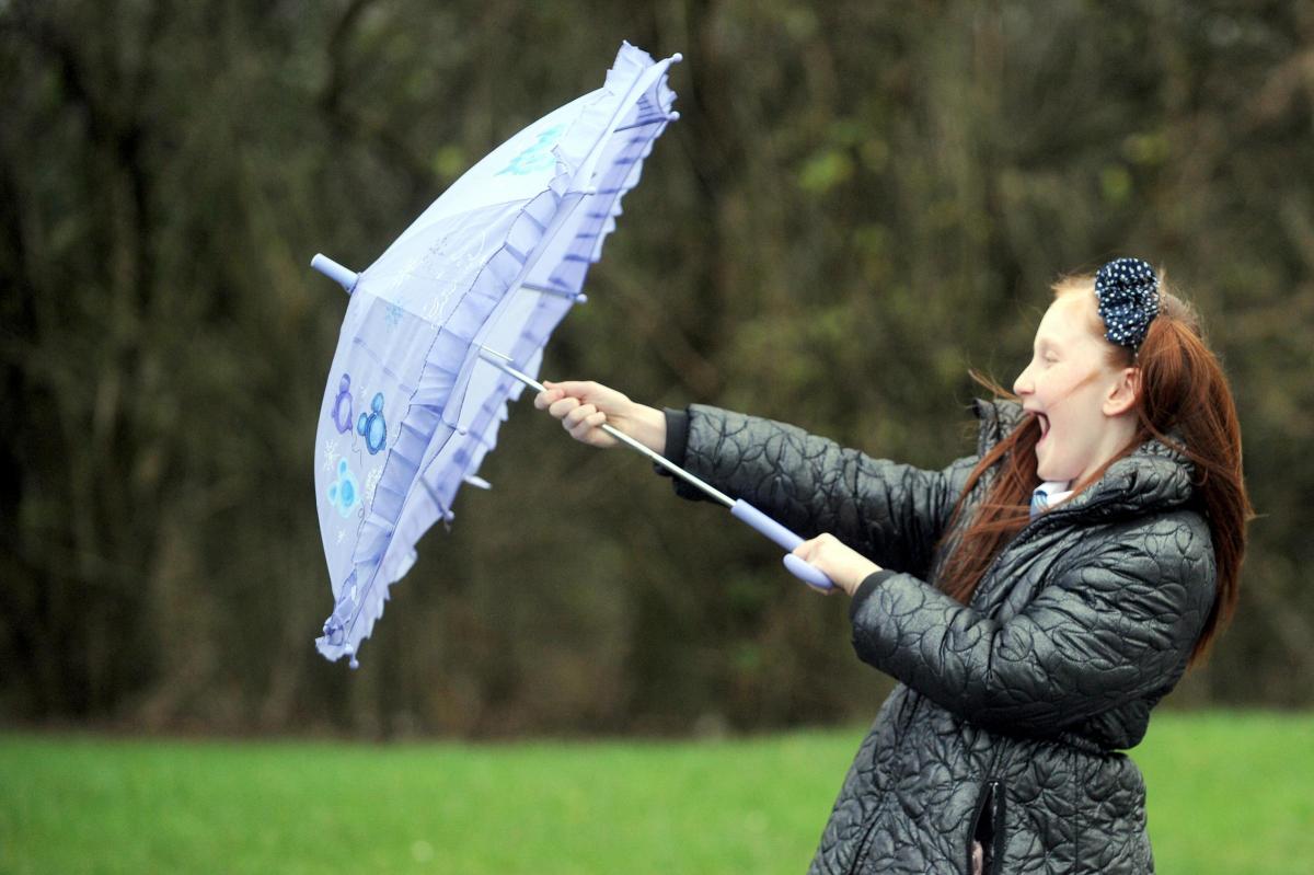
Storm Evert has arrived, bringing coastal gales and rain across the region.
High winds spread into other coastal counties in England during Thursday night and are expected to continue into Friday morning, before easing from the west later on.
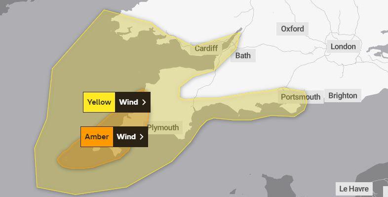
A yellow warning remains in place for Southampton and other parts of Hampshire.
Coastal areas have been warned of high gusts, mainly between 40 and 60mph, bringing with it the chance for some travel disruption and damage to temporary structures, a Met Office spokesperson said.
Residents are being urged to be careful between 8pm tonight and midday tomorrow due to the gale force winds.
Winds of nearly 50mph are forecast for coastal areas including Milford on Sea on Friday morning, while Southampton will be hit with gusts of up to 40mph.
Yellow warning of wind affecting London & South East England https://t.co/w4pnmPLy33 pic.twitter.com/aop1s5BIiQ
— Met Office warnings - SE England (@metofficeSEEng) July 28, 2021
The yellow warning says: "There is a slight chance of some damage to buildings, such as tiles blown from roofs.
"There is a small chance of longer journey times or cancellations as road, rail, air and ferry services are affected.
"There is a small chance that some roads and bridges could close.
"There is a small chance that injuries and danger to life could occur from large waves and beach material being thrown onto sea fronts, coastal roads and properties."
Storm Evert is the first storm to be named in July by the Met Office’s storm naming group with Met Éireann and KNMI. However, named summer storms aren’t unprecedented and two were named in August 2020, when Storm Ellen (19-20 August 2020) and Storm Francis (25 August 2020) moved into UK shores.
Following Storm Evert, unsettled conditions are set to return for much of the weekend, with some persistent rain in southeastern Scotland and northeast England at first with a continued risk of some thundery downpours in southern and central England, which become confined to the far south by Sunday.


Comments: Our rules
We want our comments to be a lively and valuable part of our community - a place where readers can debate and engage with the most important local issues. The ability to comment on our stories is a privilege, not a right, however, and that privilege may be withdrawn if it is abused or misused.
Please report any comments that break our rules.
Read the rules hereLast Updated:
Report this comment Cancel