
Looking north from the east side of Swaythling station is the Fleming Arms, a Georgian building with an impressive pillared porch.
The pub is now remembered for having had the world-famous Reggae musician Bob Marley perform in a nightclub in the rear car park.
It was in this pub in 1946 that a group of friends decided to form a football club known as Swaythling Athletic.
Originally they played on the Common but by 1950 they were known simply as Swaythling and were playing in the Hampshire League.
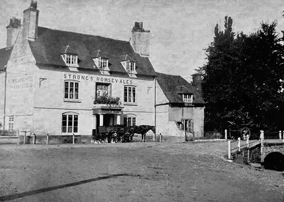
The Fleming Arms.
By 1957 they had moved to Ten Acres in Stoneham Lane where they remain today.
In 1980 they were renamed Eastleigh FC and in 1986 they were founder members of the Wessex League.
READ MORE: The history of Swaythling, Southampton – part 1 of 2 >>>
Their on-pitch success and the club's careful management means that today they play in the Conference Premier / National League and are affectionately known as the Spitfires.
East from the pub across the bridge over Monks Brook, a tributary of the Itchen, is a Greenway.
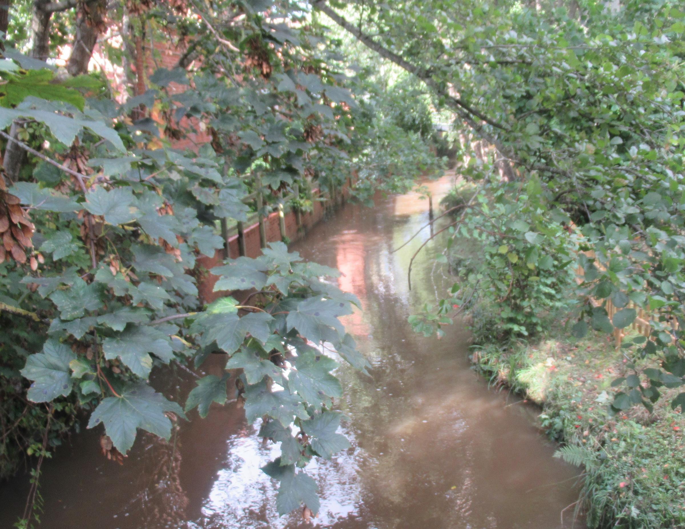
The Monks' Brook.
This has been created on the site of the Grange, a substantial grade 2 listed building dating from the 17th century originally owned by the Priory of St Denys and later by Richard Cromwell, son of Oliver.
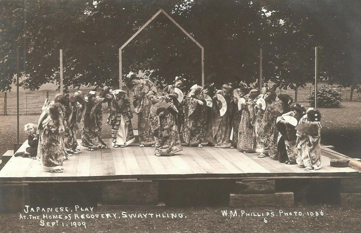
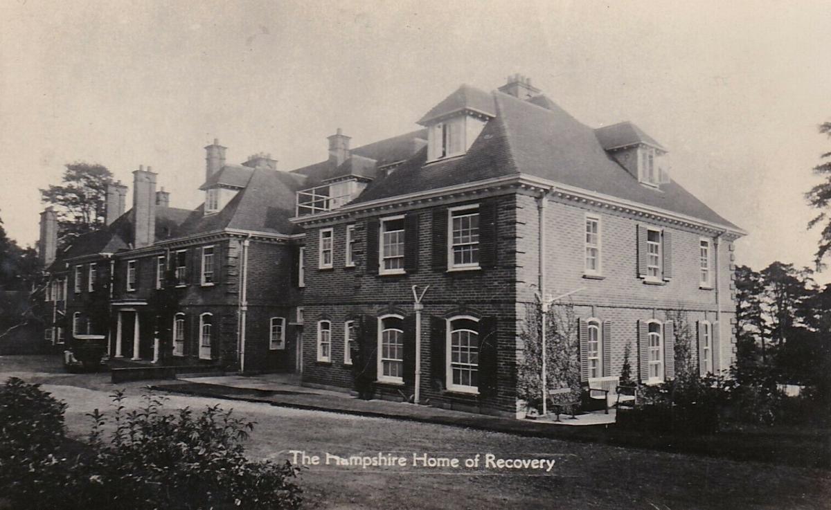
Now demolished, it had been the original location of the Home of Recovery, an experimental convalescent home to help patients adjust from hospital treatment before returning home.
This had a short existence before being closed in 1912 and replaced 10 years later by Fred Woolley House located in Stoneham Park House which closed in 1996.
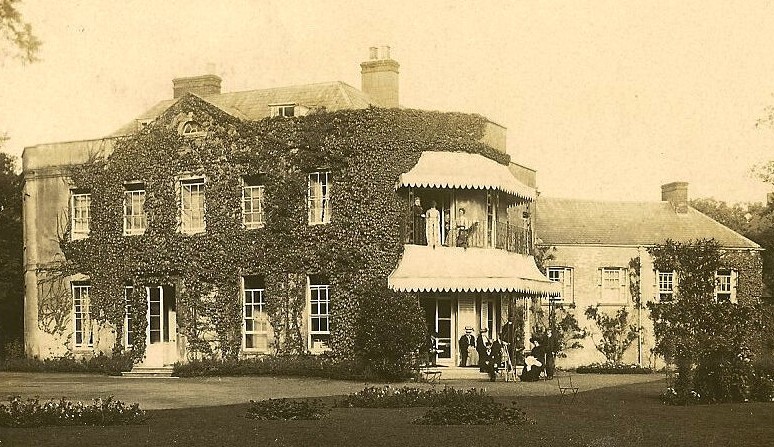
The Grange.
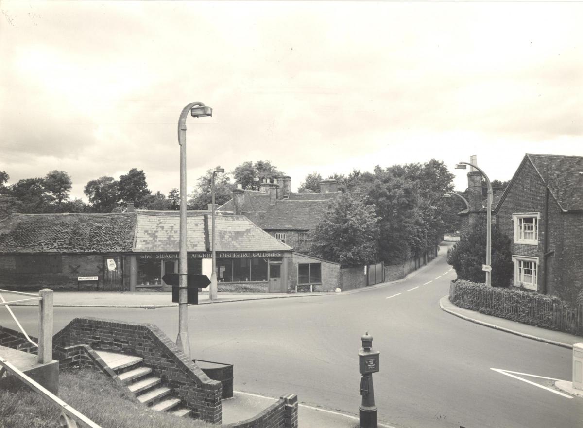
Along the Mansbridge Road can be found the South Stoneham municipal cemetery, opened in 1905.
The first burial took place here on February 4 that year.
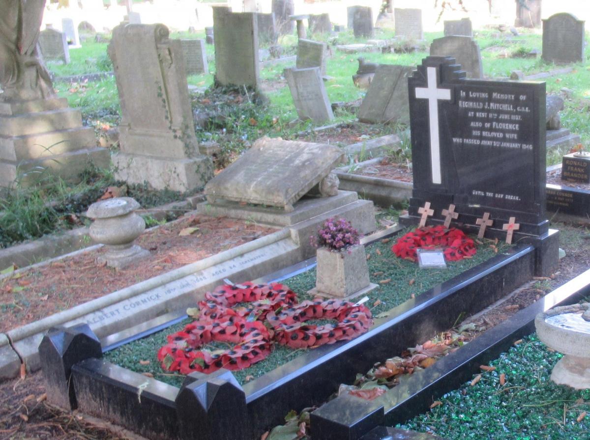
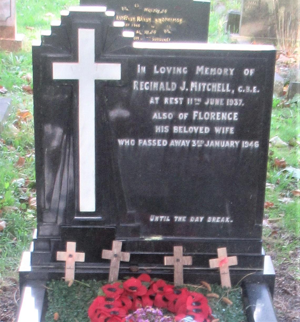
It was in this cemetery in 1937 that R J Mitchell was buried. Mitchell was the designer of the Spitfire but sadly died from cancer before he could witness the success of his iconic aeroplane and the important role it played in the Battle of Britain.
A short distance from the cemetery, are the remains of the Mansbridge Reservoir which was constructed following a Parliamentary Act of 1850.
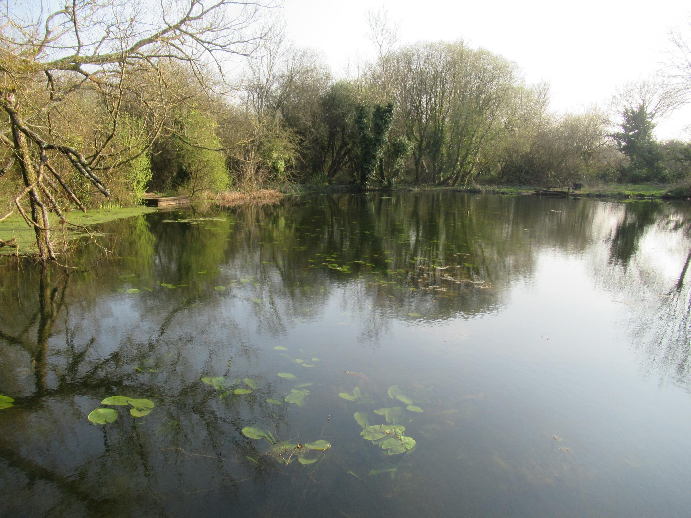
The reservoir at Mansbridge that supplied Southampton's water.
Water was pumped from this reservoir to two open reservoirs at the top of Southampton Common where it flowed into the town’s supply.
Unfortunately the Itchen at Mansbridge was polluted and filtering was proposed to cleanse the water taken but once effectiveness and costs had been calculated it became clear that a more viable solution was needed.
The reservoir was abandoned and water was taken from the Itchen at Otterbourne instead.
Today Mansbridge Reservoir is part of an attractive public space frequented by anglers and covered in water lilies.
Located off Wessex Lane is the church of St Mary’s, South Stoneham which was the original village church for Swaythling and is Southampton’s second surviving medieval church. Parts of the Chancel date back to the Normans in the 12th century. Some of its bells are claimed to be over 400 years old.
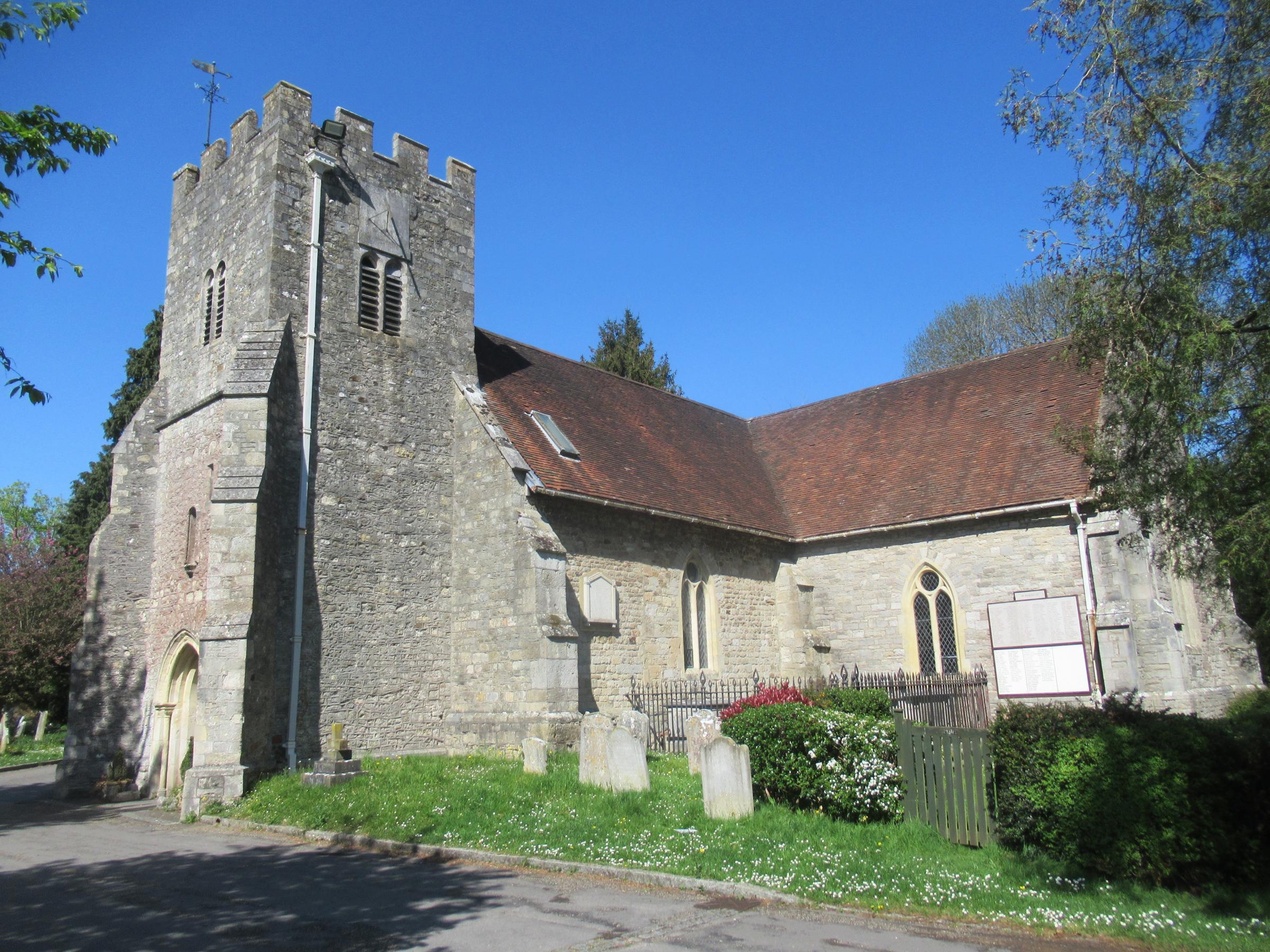
St Mary's Church South Stoneham.
The church was originally in the care of the Benedictine monks at Winchester Cathedral hence the name Monks Brook for the local stream that feeds the Itchen.
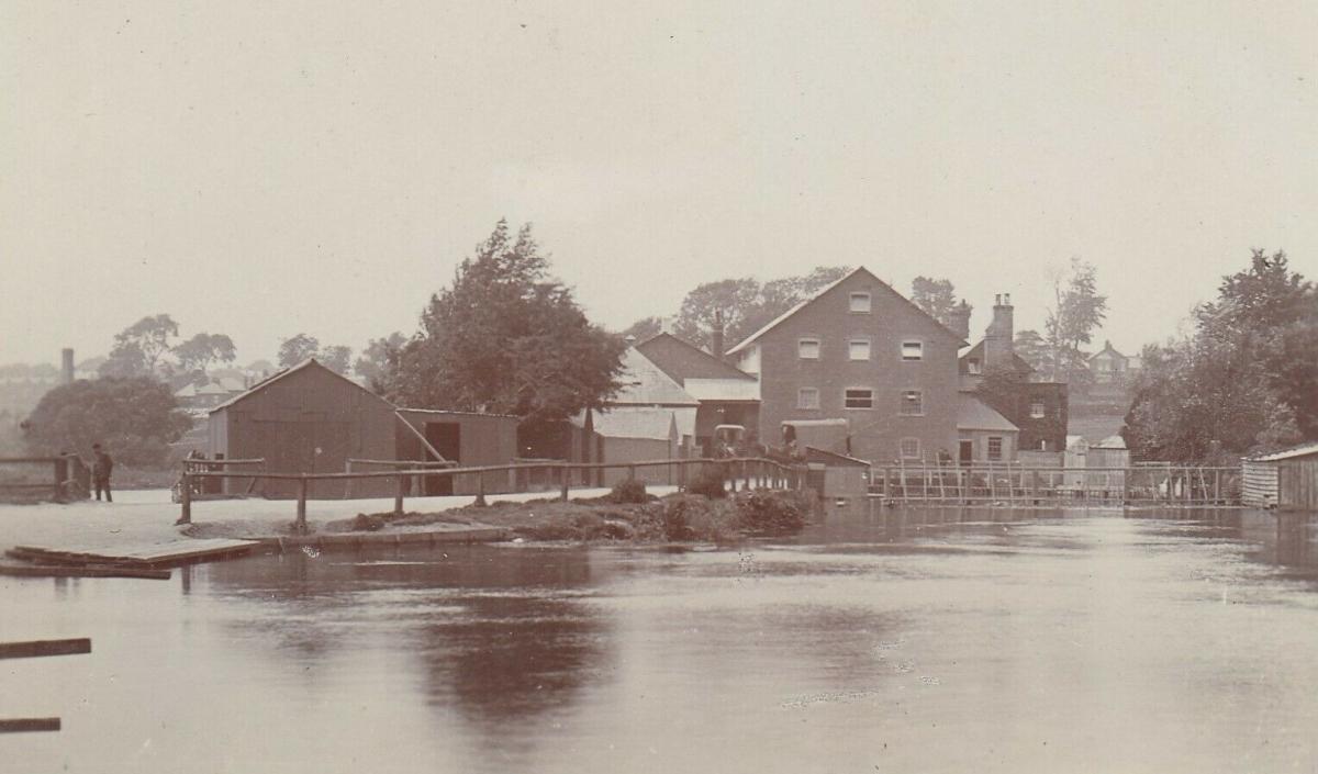
Buried in the churchyard is Walter Taylor who manufactured components for the Royal Navy including pulley blocks at his workshop at Woodmill.
It is said that his pulley blocks gave the Royal Navy’s ships greater manoeuvrability and increased firepower which contributed to Nelson’s victory at Trafalgar.
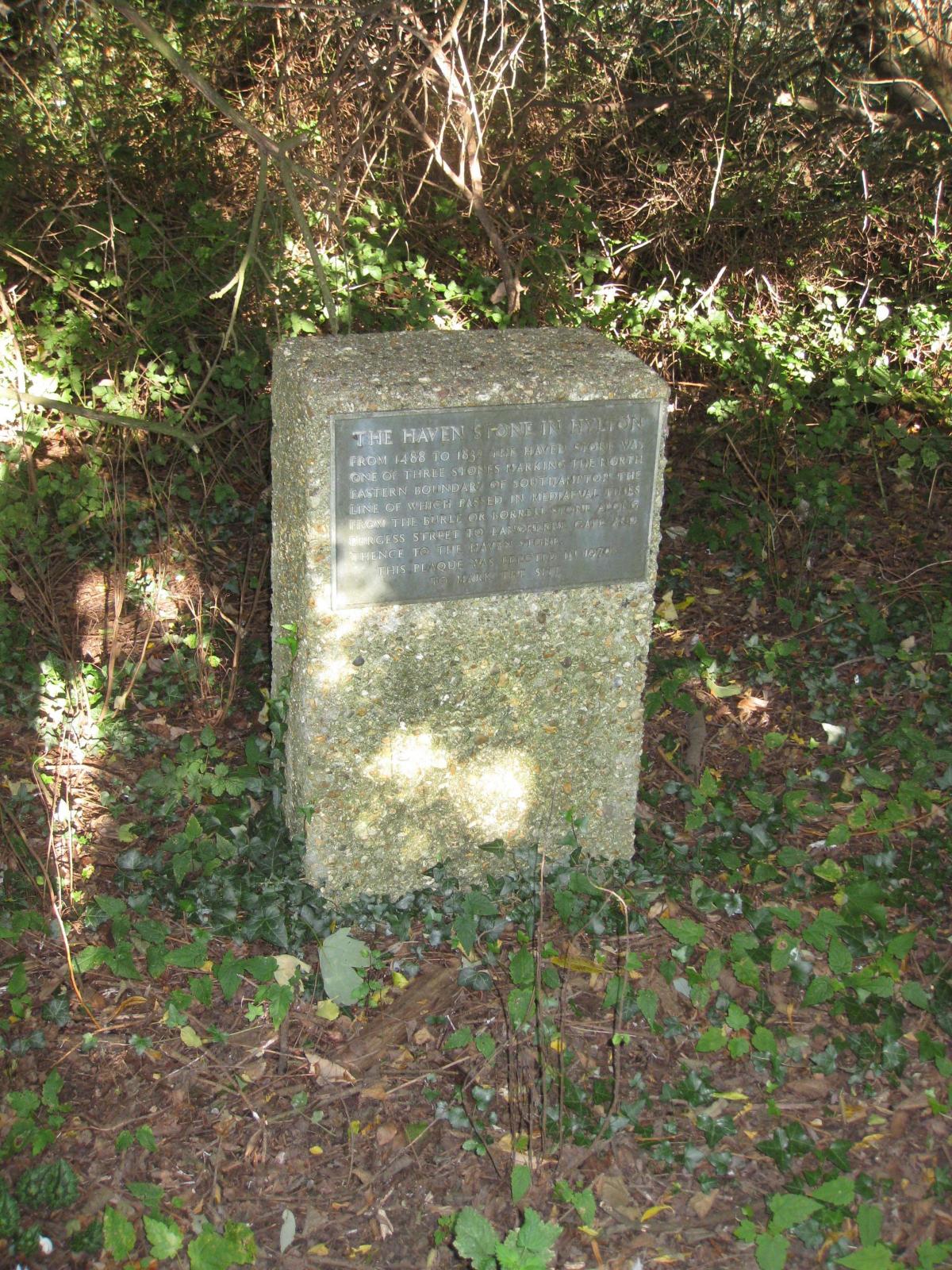
Positioned close by Woodmill and on the western bank of the River Itchen is an important boundary marker for the Saxon town of Southampton known as the Haven Stone in Hylton.
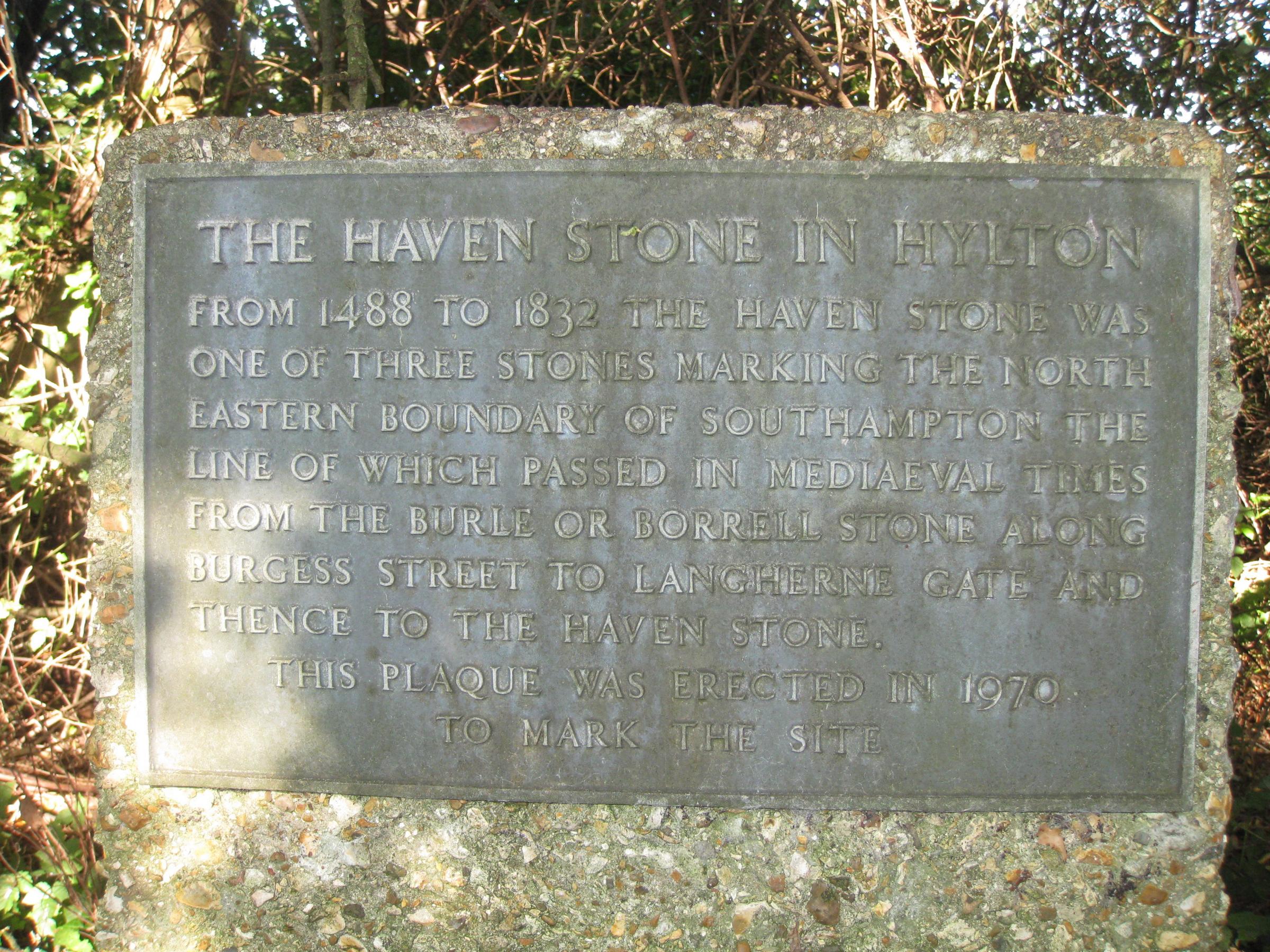
The Haven Stone.
The original stone recorded as early as 1488 no longer exists but has been replaced with a modern stone and plaque.
Two other boundary stones were nearby, the Langhorn Gate stone which was on the west corner of Burgess Road and Langhorn Road and the Burle or Borrell stone that was further along Burgess Road almost opposite the library.
The location of these boundary stones are marked on OS maps.


Comments: Our rules
We want our comments to be a lively and valuable part of our community - a place where readers can debate and engage with the most important local issues. The ability to comment on our stories is a privilege, not a right, however, and that privilege may be withdrawn if it is abused or misused.
Please report any comments that break our rules.
Read the rules hereLast Updated:
Report this comment Cancel