

This is a scenic walk from Winchester to Twyford using bridleways that cross Twyford Down and, after a suggested lunch stop in Twyford, a walk back following the former Itchen Navigation.
Park at the St Catherine's Park and Ride site – modest charges apply Monday to Saturday but are free on Sundays. Do not forget to display the right part of your ticket.
With your back to the toilet block whilst looking at the bus stop, go right along a shared route path between the car parking spaces and a tree belt. It leads via open space to Bull Drove (0.22 miles).
Go under the bridge that used to carry the Southampton to Newbury line (0.26 miles) and go left into the Garnier Road Car Park.
Go through the car park with the former Itchen Navigation on the right and take a wide tarmac bridleway running above the former towpath below that is in need of repair.
It seems difficult to imagine, but before the former Winchester Bypass was constructed this used to be a road from Twyford into Winchester with the railway running parallel above to the left.
When the trees on the left end (and there are fewer now with the death and clearance of the ash trees) and with an old lock on the right, go left through a bridle gate to head up a valley (0.75 miles).
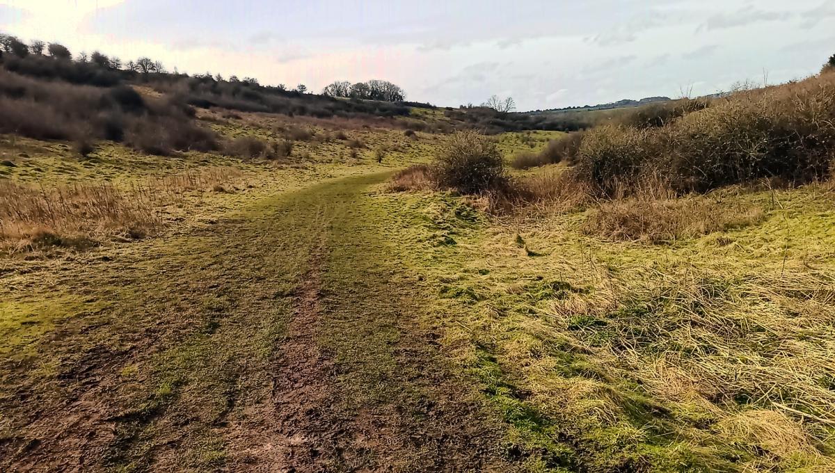
Continue up the valley ignoring the path that climbs up St Catherine’s Hill. During the Black Death, bodies were dumped in the valley in pits.
Keep to the bottom of the valley but it is a steady climb to go through a bridle gate at the top (1.31 miles).
Continue straight on across a bridge over the M3 and then immediately right through a bridle gate (1.38 miles).
Continue uphill, taking the left fork in 20 metres. Cross an ancient ditch and aim for a bridle gate ahead (1.5 miles).
Look back to enjoy the views over Winchester. 235 feet of ascent so far.
The bridleway continues beyond the gate in the same direction between fences with fields on both sides.
Soon Hockley Golf Course is on the right (1.6 miles).
The track descends into a valley, but take care the exposed chalk can be slippery when wet.
At the bottom is a cross roads of bridleways.
The Pilgrims Trail to Mont St Michel goes straight on but to get to Twyford turn right (2.08 miles).
The Golf Course is still on the right and the track gradually climbs to the top of Twyford Down at 85 metres in height.
At 2.63 miles ignore a footpath on the right which leads down through the golf course and keep to the track.
It is level for a while and then it starts to descend.
Cross a vehicular farm road (3.15 miles).
On reaching the B3335 (3.32 miles) go left along it keeping to the footway.
The road climbs over Cox's Hill to Twyford and near the top ignore Shipley Road on the left (3.56 miles) and just before Bourne Lane turn right down Church Lane (use the pedestrian crossing if there is a lot of traffic).
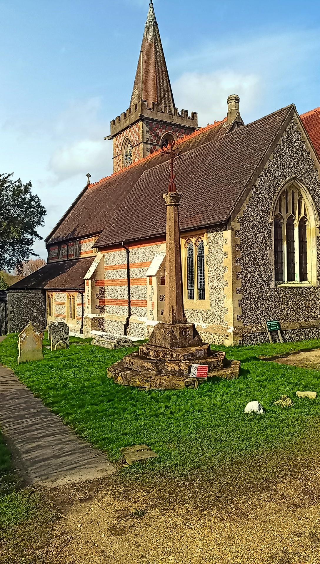
On reaching the church, turn left on a track passing to the left of it (3.74 miles).
Pass to the left of a pair of gates and continue along the track crossing straight across Old Rectory Lane onto a tarmac path between fields.
It descends to the B3335 where it is called High Street and continue to the cross roads in the centre of the village (4 miles).
There are several options for refreshment or lunch in Twyford.
There is the River Bean Café and Bar in the north east corner of the crossroads.
If you continue along the High Street going south uphill slightly you will find the Phoenix Inn on the right and the Bugle opposite to the left.
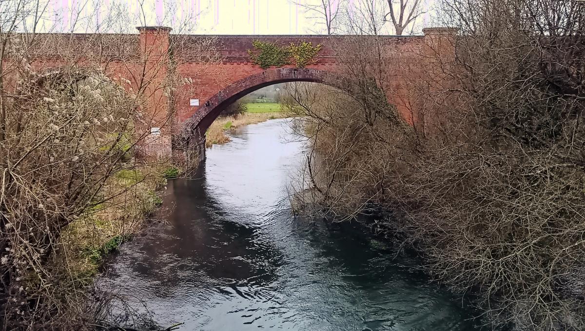
From the cross roads go west along Finches Lane to leave Twyford behind and cross the River Itchen via Norris’s Bridge (4.27 miles). The Lane is now called the Shawford Road.
Keep following the Lane until you reach the former Itchen Navigation in Shawford (4.66 miles). Beyond is the Bridge Inn, another potential lunch venue.
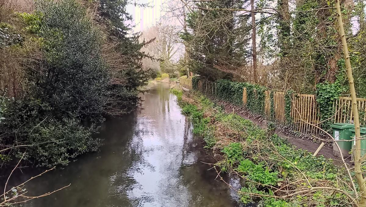
Turn right along the former towpath now following the Itchen Way waymarks and keeping the watercourse on your left.
The guidebook for the Itchen Way is available at Winchester Tourist Office in the Guildhall.
The former Compton Lock is passed at 5.06 miles, and Tumbling Bay at 5.58 miles, where the River Itchen goes down right.
Continuing straight on, you are now following the River Itchen where it was part of the former Navigation.
At 5.68 miles and before reaching the M3, leave the river and go right along the Itchen Way following the former towpath - although the navigation next to it on the left is almost silted up – can you spot the remains of a lock?
On reaching the B3335 (5.79 miles) go left on it under the M3 and straight on via a pedestrian crossing to pick up the Itchen Way (now a shared use route) on the other side (5.93 miles).
Follow this wide tarmac path ignoring the route to St Cross on the left (a former road) (6 miles).
[At this point there is an option to go up another path on the left to go part way along the Hockley Viaduct to enjoy a high-level view over the river Itchen.]
Go under a bridge taking the former Southampton to Newbury line, (7.10 miles) and continue on the wide tarmac track with the former Navigation on the left again and when St Catherine's Hill is in sight. The outward route is joined at 7.36 miles.
Follow the reverse of the outward route still with the former Navigation on the left until a car park is reached (7.78 miles) where there is The Handlebar Café up to the right.
Join the road, turn right, go under the bridge and fork left on the path to the car park and the start at 8.12 miles.
If you want more walks like this, go to hampshireramblers.org.uk and look up your local Group.
For those who have a digital subscription you will find the previous suggested walks in the editions on 27 January, 10 February, 24 February and 30 March.
Written by Richard Kenchington, Hampshire Area Walking Environment Officer for the Ramblers’ Association.


Comments: Our rules
We want our comments to be a lively and valuable part of our community - a place where readers can debate and engage with the most important local issues. The ability to comment on our stories is a privilege, not a right, however, and that privilege may be withdrawn if it is abused or misused.
Please report any comments that break our rules.
Read the rules here