
Have you ever wondered how your area got its name?
These are some of the districts of Southampton explained.
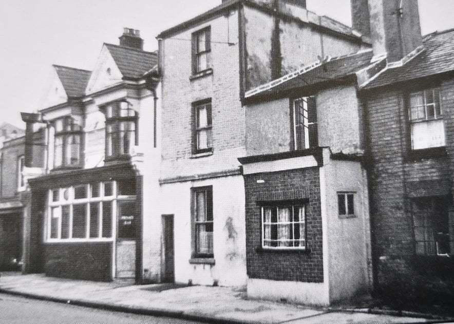
Nicholstown
Nicholstown is a small area to the north-east of Southampton’s City Centre. The area was also known as Newtown, and as Chamberlayne’s Town, as that family once owned the area.
Jonas Nichols (1836-91), originally from Somerset, came to Southampton in 1859 and became a successful furniture maker, later branching out into property development and house building.
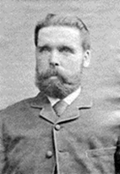
He mainly built houses for working-class people in the area to the east of East Park, which was known as Nichol’s Town in his honour. He also built some of the large houses in the Northlands Road area and Nichol’s Road was named after him.
READ MORE: From Mansbridge to Northam – how did your area get its name? >>>
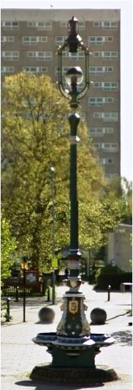
The Jonas Nichols Fountain was presented by him to the town in 1882, to commemorate his son Sidney attaining his majority. The fountain was originally sited at Six Dials, but was moved to Kingsland Square, Bevois Street in 1904. In 1990, this part of Bevois Street was renamed Jonas Nichols Square
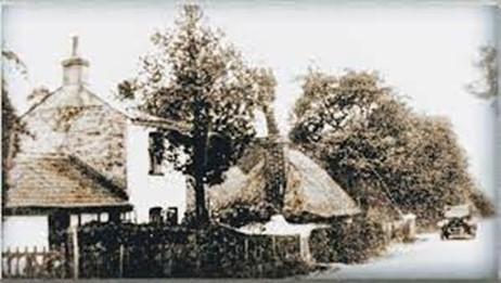
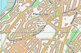
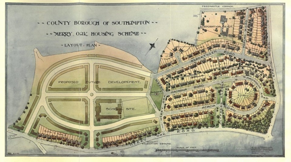
Merry Oak
Merry Oak is a district immediately east of Peartree Green.
An aged oak marking the Sholing boundary is recorded opposite the Green, and is plotted on Philip Brannon’s map of 1871.
READ MORE: From Redbridge to Bitterne – how did your area get its name >>>
Possibly ‘merry’ signifies ‘mearce’, ‘the boundary oak’.
Merry Oak House was built in c.1800, probably for Hugh P Keane, who lived there until about 1810. The house was demolished in the 1920s and the estate was acquired by the council for housing development.
The original driveway with its avenue of trees was preserved and included in the new housing estate as Cypress Avenue.
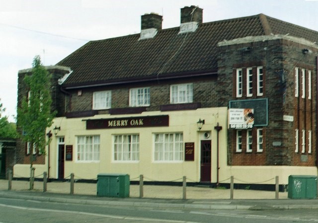
The name was given to Merryoak Road, Merryoak School (now closed), the Merryoak Community Centre and The Merryoak Pub, now a vet’s and accommodation.
The family home of See Southampton’s very popular and much-missed guide Steve Roberts, who recently passed away, is in this area.
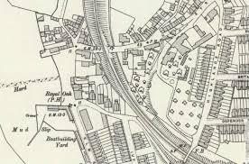
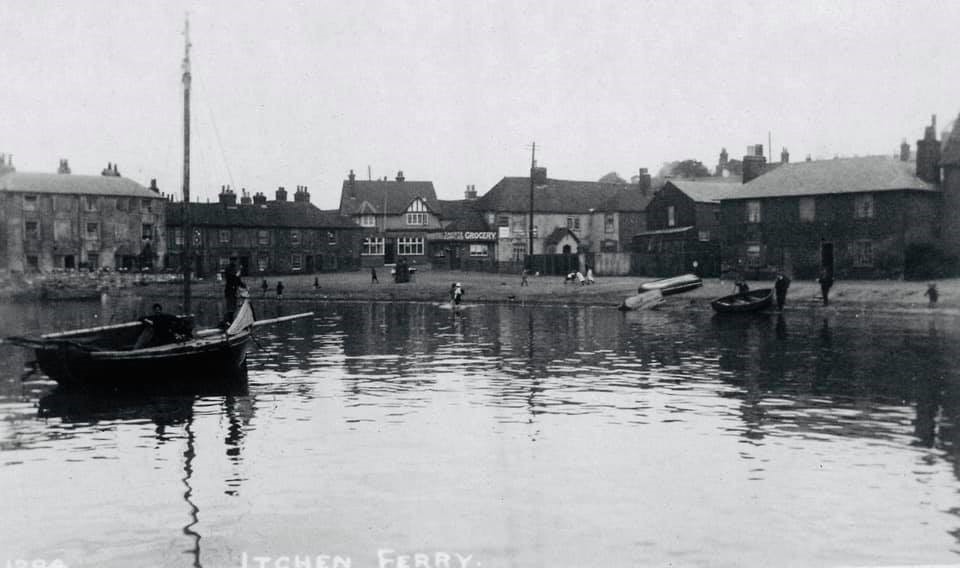
Itchen
Itchen is a district on the east side of the River Itchen, sometimes referred to as Itchen Ferry Village or simply Itchen Ferry.
For many years the Itchen ferrymen were granted permission to run a ferry for foot passengers and goods by the Lords of the Manors of Woolston and Southampton who received free passage. The Village took its name from this ferry run by small fishing boats.
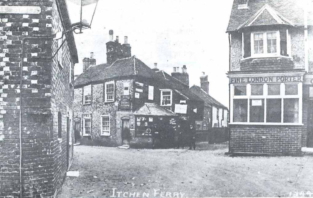
It lost a large part of its livelihood when the Floating Bridge was introduced in 1836 but continued to operate a night service until the late 19th century.
The Village was destroyed by the Luftwaffe on September 26, 1940, due to its misfortune of being a stone’s throw from the Supermarine factory and a short distance up-river from the John I Thornycroft & Company shipyard.
There were more than 100 casualties, but that was not the only raid. The Luftwaffe had targeted the area on a number of previous occasions. An air raid shelter in the lower region of Sea Road, near the railway line, is reported as receiving a direct hit on September 24, 1940.
READ MORE: How parts of Southampton got their name >>>
The area to the south was subsequently used for training troops that would be fighting in similar ruined villages during the invasion of Europe in 1944, and it became known as “the Street Fighting area”.
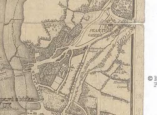
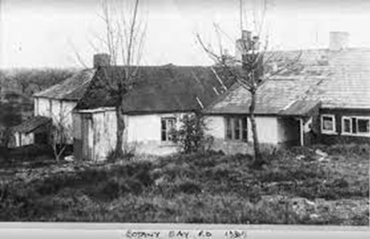
Botany Bay
Botany Bay is a name for the district between South East Road and Portsmouth Road in Sholing - the valley of the more easterly of the streams feeding Miller’s Pond.
The first printed record of it as a place name was in the Southampton Street Directory of 1859 but it was probably in oral use long before this.
The origins of the name are obscure, but may be a reference to Sholing’s remoteness – it was sparsely-populated heathland for much of the 19th century.
Lieutenant James Cook first landed at Botany Bay in 1770 when navigating his way up the east coast of Australia on his ship HMS Endeavour. In the journal prepared later from his log, Cook wrote “The great quantity of plants Mr. Banks and Dr. Solander found in this place occasioned my giving it the name of Botany Bay”
READ MORE: Do you know how the area you live in got its name? >>>
The term then became used colloquially, and often ironically, for any distant place.
Botany Bay was the site of the original convict settlements, to which British criminals were transported from 1778.

Jack Wilson is a tour guide with SeeSouthampton.co.uk .


Comments: Our rules
We want our comments to be a lively and valuable part of our community - a place where readers can debate and engage with the most important local issues. The ability to comment on our stories is a privilege, not a right, however, and that privilege may be withdrawn if it is abused or misused.
Please report any comments that break our rules.
Read the rules hereLast Updated:
Report this comment Cancel